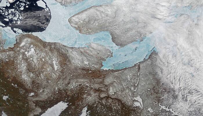
New Delhi: NASA has released a stunning image of ice covering the Amundsen Gulf, Great Bear Lake, and numerous small lakes in the northern reaches of Canada’s Northwest Territories and Nunavut.
The image was captured by the Moderate Resolution Imaging Spectroradiometer (MODIS) onboard NASA’s Terra satellite on On May 29, 2017.
Sea ice generally forms in the Gulf of Amundsen in December or January and breaks up in June or July. Lake and river ice in this area follow roughly the same pattern, though shallow lakes freeze up earlier in the fall and melt earlier in the spring than larger, deeper lakes, says NASA.
Icy lakes and rivers make a significant footprint on the Arctic landscape, while also affecting the people who live there.
Since lakes and rivers have the highest evaporation rate of any surface in high latitudes, understanding and monitoring seasonal ice cover is critical to accurately forecasting the weather and understanding regional climate processes.


